Filed Under Story

Construction of the Town
US Steel needed laborers to build its steel mill and the city of Gary. A subsidiary of the steel mills, the Gary Land Company was tasked with constructing the town as well as housing for its workers. The Gary Land Company hired engineers such as A.P. Melton, who at that time, was working at the Illinois Steel plant in South Chicago, to lay out the town site and to oversee the planning, development, and building of what would be the First Subdivision of the town of Gary. Others like Ralph E. Rowley and Thomas H. Cutler were also brought in to help layout and construct the new town. Known as “company men,” these were individuals whose loyalty to their employer was more important than their personal beliefs or the welfare of their fellow workers. These “company men” and others would later become leaders in the community.

While 9,000 acres were purchased for the mills and town, about 800 acres south of the mills were set aside for the First Subdivision that would include houses for permanent workers.

On April 18, 1906, the first stake was driven into the sand at 5th and Broadway for what was to become the city of Gary. The first building constructed was a wood framed, two-story building to house the Gary Land Company offices. From there the company would oversee the selling of plotted lots and land. The Land Company’s plan was to create a system of streets and plots for houses in a grid pattern with a main street and prime business area that ran north and south. The main street, Broadway, would run south to 9th Avenue. Favoring an east and west expansion, 5th Avenue ran to Fillmore Street. The eastern border of the First Subdivision was Tennessee Street. Construction of buildings then began on Broadway and included several businesses while churches, the city municipal building, and the first school were constructed nearby.

As Gary expanded, it incorporated several of the towns located to the east and west, a move favored by mill officials. The town’s president favored expansion to the south, past the First Subdivision. This would include lands not planned or developed by the Gary Land Company. This area, known as the Patch, was ripe for unscrupulous builders and landlords who constructed poorly built houses that soon became overcrowded. The area was also home to more than 100 bars. Crime and violence were frequent in the Patch. In comparison, the north side that was built by US Steel only had four liquor licenses. Gary basically operated as one city in name but with two different and distinct parts.

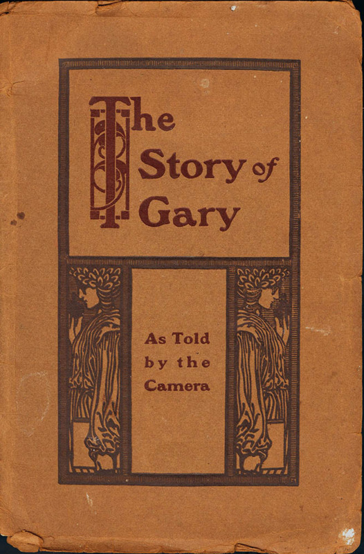
The success of the mill’s construction, the building of the planned town, parks and schools provided an opportunity for some to help market Gary to outside investors, businesses, and people who continued to arrive with hopes of leaving their mark on the “City of the Century.” One such businessman employed the photographs of a local photographer, Thomas Crose, to create a “show” of Gary’s finest areas, buildings and parks. Shown in the local theater, the “photo show” was designed to travel to other theaters outside of Gary. Gary’s progress was also documented in handbills, brochures, and booklets such as “The Story of Gary As Told by the Camera,” a booklet created by real estate agent H.H. Harries in 1908. Harries touted the unrivaled opportunities available in real estate and other investments available in the young town with many photographs of its meteoric rise in its eighteen months of existence.

Images

Jefferson Park
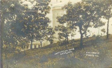
Jefferson Park Originally named “City Park” and “West Side Park,” and planned in 1905, the year before any construction of the mill or the town had begun, Gary’s first park was also its first landmark. One of its many striking features is its landscape of sand dunes. As reported in the local newspaper, the Gary Tribune, the sand dunes were to “be preserved as mementos of the time when the entire region consisted of dunes.” Today, the public can still see these grass covered dunes. Creator: The Crose Photo Co. Date: 1908
5th and Broadway
5th and Broadway This is what the future location of what became Gary’s premier intersection, that of 5th Avenue, east and west, and Broadway, north and south, looked like on April 18, 1906, the day that the first stake was driven into the ground. Brothers Thomas and Armanis Knotts (left and center) were photographed on the site. Thomas became Gary’s first mayor, and Armanis later was involved significantly in the first attempt to create a national park for the Dunes. Source: Gary Public Library Creator: Attributed to Frank Bick Date: 1906
Gary Land Company
Gary Land Company Constructed in May 1906, this was Gary’s first office building. It housed Gary’s postal facilities as well as the Land Company. The Land Company determined Gary’s street, block, and lot layout before any building took place. In addition to determining the shape of the future city, the Land Company also installed all utilities, built gas and electric plants and a sewer system, and donated lots for, among other things, schools, churches, a hospital, and municipal buildings. Source: Gary Public Library Creator: The Crose Photo Co. Date: 1908
First Subdivision
First Subdivision Platted in 1906 or shortly thereafter, all the lots along the east-west streets face 5th Avenue since the Gary Land Company thought that it would be primarily commercial and the main street in Gary. 5th Avenue and Broadway, 80 and 100 feet wide, respectively, show the company’s ambitions for the new city by naming their streets after those found in the largest city in America, New York City. Source: Gary Public Library Creator: Gary Land Company Date: 1906
"Shack Life in Gary"
"Shack Life in Gary" Living conditions early on were pretty rugged, even on the north side, as residents and workers had to make do with makeshift housing while the more well-built and permanent structures were being constructed. Shacks lacked indoor plumbing, electricity, heating, or insulation. The buildings were easily damaged by high winds and their roofs frequently leaked during heavy rains, or collapsed during heavy snows. These wooden buildings were also highly flammable. Source: Gary Public Library Creator: The Crose Photo Co. Date: 1908
Under Construction
Under Construction The First Subdivision ran south about one mile from the mills, accessible by its main street, Broadway, that ran north and south. The town’s president favored expansion further south, in conflict with mill officials who favored an east and west expansion. The first town board extended paving Broadway two miles south of the First Subdivision and by 1910 it was paved an additional two miles. A streetcar franchise was later awarded and helped to further expand Gary’s southern growth. Source: Gary Public Library Date: 1907
Laying Big Sewer
Laying Big Sewer This sewer system was built to accommodate a city of two hundred thousand when it was constructed in 1906-07, even though Gary did not approach that population until about fifty years later. The sewers were constructed in the alleys so that the streets wouldn’t be blocked when regular maintenance or repairs were done. The total length of the sewer system in use was 19.5 miles as of the beginning of 1909, and the large outlet sewer was eight feet in diameter and made of concrete. The initial design of the sewage plant was done with the future development of the system being of some consideration, which was not common at this time. Alvord and Burdick, Chicago engineers, were hired to provide Gary with a water system and sewers. Source: Gary Public Library Date: 1906-1907
Construction
Construction Here is a snapshot of where construction of neighborhoods was in Gary on the last day of Gary’s first year of existence, December 31, 1906. The Gary Land Company, up until 1909, had a policy in which the homebuyer would have to construct a home within 18 months after purchasing land. The Land Company, in return, laid out streets and installed utilities in alleys to simplify maintenance. Source: Calumet Regional Archives Indiana University Northwest Date: 1906
Broadway
Broadway Quite a bit of progress had been made in one year (this is July 1907) in the construction of the streets and the buildings here at the primary intersection in Gary, 5th Avenue and Broadway. In various stages of completion, you can see the Gary State Bank in the upper left-hand corner; the H. Alschuler Company Building at upper right; and the Gary Heat, Light, and Water Company at the far right. Even with this rapid construction Broadway would not have electric lights until May of 1908, the first street in the city to have them. Source: Calumet Regional Archives Indiana University Northwest Date: 1907
Van Buren Street
Van Buren Street Here is a photo of a residential area on Van Buren Street, a north-south street on the West Side of Gary’s First Subdivision. Most of the exteriors appear to be completed or mostly completed. Note that this photo was taken in 1908, only two years after Gary’s creation, and also that Van Buren is seven blocks west of Broadway. Many of these homes were constructed to be as close to the mill or its subsidiaries as possible for mill supervisors, upper management, and skilled workers. Source: Gary Public Library Creator: The Crose Photo Co. Date: 1908
Photo Book
Photo Book With the rapid growth and construction of the city and the steel mills, businessmen with interests in bringing more people into Gary prepared booklets, brochures, and even a picture show to promote Gary to the world. One of the city’s most prolific photographers, Thomas Crose, took many of the photographs used in such advertisements. He also created many of the postcards of the town’s construction, people, and events that were used to promote Gary to outside investors and businesses. Source: Gary Public Library Date: 1908
Lake Co. Map
Lake Co. Map A map of the industrial areas of northern Lake County, circa 1909. Gary’s First Subdivision is visible below the US Steel plant and above the Wabash Railroad, indicated with a red line. From east to west the First Subdivision ran from Tennessee Street to Fillmore Street. Laid out into over 100 blocks, each block in the First Subdivision was plotted with 26, 40, 42 or 44 lots. Source: Map Collection, Indiana Division, Indiana State Library Creator: Indiana Harbor Belt Railroad Company Date: 1909

Location

750 Madison St, Gary, IN 46402

Metadata

Gary Public Library, “Construction of the Town,” Discover Indiana, accessed October 22, 2026, https://discoverindianahistory.org.curatescape7.reclaim.hosting/items/show/601.